30 Must Do Hikes With Your Dog In Kananaskis, Alberta
We are very fortunate to have Kananaskis Provincial Park in our backyard if you live in Calgary. Many tourists flock to Banff but locals know this is where it's at. Especially if you have a dog so we are super excited to bring you this dog hiking blog!
This is the ultimate dog hiking guide in Kananaskis with 30 hikes to do with your dog, yes!! Not 5, 10, 15 or 20 but 30 hikes to do in Kananaskis with your dog from very easy 20 minute hikes to the most difficult like Sarrail Ridge.
These are all hikes we've done and are confident there is nothing too strenuous in our list, that said, some of these hikes are not easy so please do your own research and know the limits of yourself and your dog.
Before you head out here are some things to think about:
- Be sure to purchase a Kananaskis Conservation pass before starting the hike
- Before you go, check out the Alberta Parks trail report.
- Be sure to bring enough food and water for yourself and your dog
- Check your dog for ticks when you get back from the hike
- Have the proper navigation, maps and apps like AllTrails
- Always carry bear spray, knife and first aid kit
- Always bring more clothes/layers than you need
- Bring sun protection
- If you are hiking before dawn or close to sunset have a headlamp or flashlight
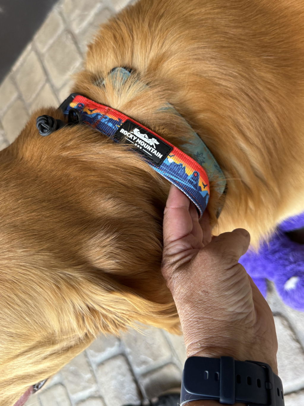
And make sure you have all the right dog gear:
- Leashes - hands-free leash or rope leash
- Harness - All-Terrain Harness
- Water - Travel bowl or saucer
- Check out all the essential dog hiking gear on our website
1. Tent Ridge

📍Trailhead - Mount Shark Road
🥾 Distance - 10.1km
🏔️ Elevation Gain - 750m
🐕 Dog Rating - Hard
🏕️ Type of Trail - Loop
⏱️ Time - 4-6Hrs
The Tent Ridge Track is rated by most Canadian hikers and guidebooks as a moderate trek, but most hikers would likely consider this on the upper end of strenuous. Ah... yes, we would agree! When you start make sure you go east to west along the trail and ridge, that way you will see Spray Lakes as you head down the trail.
The high elevation and exposed slopes will definitely zap your energy resources along the way, the scrambling sections are short and pretty mild, so don't get deterred but be ready for a little exposure. Once you make it the top of the ridge you will traverse it for 3-4 km which makes this hike so spectacular, every angle is an amazing view of the Canadian Rockies in all their glory.
The hike along the top is great for you and your dog. It is a long treverse that is a U-shape so you see every angle of the mountains along the way. There are a lot of chipmunks so be sure to have your dog on a leash. On the way down, you will have Spray Lakes in the distance. Make sure you have all the AllTrails info downloaded, it can be easy to get off trail on this hike.

2. Prairie View

📍Trailhead - Barrier Lake
🥾 Distance - 13.8km
🏔️ Elevation Gain - 451m
🐕 Dog Rating - Moderate
🏕️ Type of Trail - Out and Back
⏱️ Time - 2 - 5Hrs
The Prairie View Trail, often called the Barrier Fire Lookout trail, switchbacks uphill on an old forestry road to a spectacular viewpoint looking south over Barrier Lake. This is a perfect sunrise hike since you can get to the top view quickly. You can go straight to the top for the view and back down the same way or continue down the back side called Jewel Pass.
From the viewpoint, visitors can either continue to the north side of the ridge to that Barrier Fire Lookout and a view over the Bow Valley then make your way down the same way you came. This makes it about a 3hr hike.
Or you can descend towards Jewell Pass on a trail that is a little less obvious from the top, but becomes more clear as you reach the forest. This way you go back down behind the mountain and around the other side ended up at the other end of Barrier Lake making your way back on the west siide of the lake.
We've done both routes, if you have the time take Jewell Pass. If you are pressed for time go back down the same way.

3. EEOR (East End of Rundle)

📍Trailhead - Whiteman's Pond or Goat Creek
🥾 Distance - 5.6m
🏔️ Elevation Gain - 872m
🐕 Dog Rating - Hard
🏕️ Type of Trail - Out and Back
⏱️ Time - 3 - 4 Hrs
East End of Rundle hike is easily one of the most popular hikes near Canmore. It’s also the best effort to reward with breathtaking views of Spray Valley and Ha Ling Peak. Given its proximity to downtown Canmore and relative ease, it sees heavy foot traffic. It’s a beautiful hike that provides visitors with astonishing views over Canmore, the Bow Valley, and Ha Ling Peak.
You start this hike beside the dirt road and head up the side of East Rundle. It's steep trail up and up. When we did this hike there was still some snow at higher elevations and I wasn't too sure how to treverse the very top wiht Butch so we did not go all the way to the very top.
That said, we ended pretty high up on the trail and you have great views of Canmore, Bow Valley and Spray Valley. The first 3/4 of the trail is moderate/hard for a dog. Again, it was much more difficult towards the top with a dog or we may of been off trail so we did decided to turn around with our dogs.

4. Kings Creek

📍Trailhead - Kings Creek Day use area
🥾 Distance - 6.8 km
🏔️ Elevation Gain - 777m
🐕 Dog Rating - Hard
🏕️ Type of Trail - Out and Back
⏱️ Time - 3.5-4.5 Hrs
Hiking enthusiasts will love the extra challenge promised by the steeper climb with King’s Creek Ridge. The initial trek up to the summit is as much an outdoor escape as it is a fitness circuit! With the terrain shifting from paths hugged by teeming pines, an open meadow, a rocky canyon and three peaks offering vast views, the first snows of fall coat mountains in an iridescent shine.
All the effort will be expended during the first 2/3 of the hike but it is well worth it to traverse the ridge. You will have an excellent view of Kananaskis valley, Upper and Lower Kananaskis Lake and Kings Creek Valley. The Ridge is 2km and goes to an incredible viewpoint. You can continue down to Kings Creek behind the mountain and back or come back the same way you came which we did.
King’s Creek Ridge is best hiked from June to October when ice is at its minimum to keep the vertical climbs safe. It would be a hard hike with your dog for the first 2/3 of the hike but the trail is not too difficult and the ridge is a lot of fun with a dog with amazing vistas for pictures.

5. Edworthy Falls

📍Trailhead - Hwy 40 at Elbow Pass day-use area.
🥾 Distance - 9.7 km
🏔️ Elevation Gain - 383m
🐕 Dog Rating - Easy
🏕️ Type of Trail - Out and Back
⏱️ Time - 3 - 4 Hrs
You can hear Edworthy Falls before you see them. In 1924, George Edworthy and his wife, Myrle, found the falls in just this way. While it used to be a bushwhack to reach Edworthy Falls, nowadays, a well defined trail has developed, that is popular with backcountry campers and even horses.
This is not a difficult hike, the most strenuous is going up the incline to Elbow Lake. Once you pass Elbow Lake it is an easy hike along the valley with amazing views in all directions. You will see a sign pointing you towards Edworthy Falls.
The hike down to the Falls is a little tricky, it is steep and can be slippery if it is wet so be careful. Once down at the bottom be sure to snap some pictures of the falls.

6. Wedge Pond

🥾 Distance - 1.0 km
🏔️ Elevation Gain - 33m
🐕 Dog Rating - Easy
🏕️ Type of Trail - Loop
⏱️ Time - 20min
This is one of our go to spots to take sunrise pictures in Kananaskis. It's not far from Calgary and you can be taking amazing sunrise pictures within 5 minutes from arriving. Not bad!
This gem is located just off Highway 40 where you can take an easy 1 km hike around Wedge Pond, then enjoy a picnic lunch at one of the many picnic spots along the edge of the pond.
There are fire pits available for use as well, so you really can make a full day of it out there. And if you like to fish, canoe or kayak, the turquoise-tinged and clear water of Wedge Pond is perfect for those activities.

If you are looking for the perfect photo, head there for sunrise, we have taken many of our favourite photos here early in the morning!

7. Prairie Mountain

📍Trailhead - North side of Highway 66, 18km west of Bragg Creek turnoff
🥾 Distance - 6.6km
🏔️ Elevation Gain - 666m
🐕 Dog Rating - Moderate
🏕️ Type of Trail - Out and Back
⏱️ Time - 3 - 4.5Hrs
A 45-minute drive from downtown Calgary, the Prairie Mountain hike offers a family-friendly half-day hike featuring steep, gradual climbs and open views of prairie and mountain landscapes. Trek through this beautiful outdoor setting with the adrenaline of a good workout. Add summer birdwatching to your adventure or snowshoeing in the winter.
This is the hike that seems liike it never ends... it is deceivingly long but the upper 1/4 of the hike is wide open with awesome views east and west! We have not done a sunrise hike here since it does take a bit of time to get to the top but it would be well worth it.

8. Powderface Ridge

📍Trailhead - End of Highway 66
🥾 Distance - 11.6km
🏔️ Elevation Gain - 779m
🐕 Dog Rating - Moderate
🏕️ Type of Trail - Out and Back
⏱️ Time - 3 - 4Hrs
Powderface Ridge is a unique hike allowing you to climb a short 2.3km to the south summit, an even shorter 1.3km to the North Summit, or complete an 8.5km ridge traverse. If you plan on completing the traverse, travel from north to south to avoid extra elevation gain.
This trail offers excellent views of Mount Glasgow, Mount Cornwall, Outlaw Peak and Banded Peak. The summit offers a classic transitional view of prairies to foothills to mountains with the city of Calgary visible on the eastern horizon. Powder Face Ridge is a perfect spring time hike for getting your summer legs back in shape.
I think there is a couple different ways to do this hike, we always park at the very end of Highway 66 where the dirt road begins. This is the quickest way to the top and you can get really good views of the mountains by not going to the summit or if you are pressed for time. This is an easy hike for dogs and was one of my first hikes with Butch when he was a puppy.

9. Upper Kananaskis Lake

📍Trailhead - Upper Kananaskis Lake Parking lot
🥾 Distance - 15.4m
🏔️ Elevation Gain - 466m
🐕 Dog Rating - Moderate
🏕️ Type of Trail - Loop
⏱️ Time - 4Hrs
Upper Kananaskis Lake is man made for hydro electric power and irrigation. The lake is almost empty before spring run off in mid June. There is a lot to explore in this area. The Upper Lake has a well groomed hike or bike trail that runs around the entire lake. Beautiful views of Mount Lyautey, Mount Sarrail, Mount Foch and Mount Fox can be seen along the route.
Ok, ok we have not done the full loop here but we have done many legs of it. Our favourite part is heading to the very last parking lot of the Upper Lake, you can take some amazing pictures here and we've seen lots of wildlife along the way.
These pictures were taken in September when we were suppose to do a group hike to Rawson Lake but we had to cancel. We went up anyways and had the lake all to ourselves.

10. Galatea Lakes

📍Trailhead - Galatea parking lot/ Trail to Lilian Lake
🥾 Distance - 16.9m
🏔️ Elevation Gain - 870m
🐕 Dog Rating - Moderate
🏕️ Type of Trail - Out and Back
⏱️ Time - 5 - 6Hrs
This moderately difficult, 6.3-km hike follows Galatea Creek, crossing 11 different bridges — including a suspension bridge over the Kananaskis River — to Lillian Lake. More ambitious hikers can extend their trek by another 1.3 km to Upper Galatea Lake, which offers spectacular views of an alpine valley.
You’ll find the well-signed trailhead on Highway 40, approximately 5 km from the Kananaskis Golf Courses.The first bit to Lillian Lake is through a forest, the route above Lillian Lake is outstanding, especially the circuit around Lower Galatea Lake.

11. Porcupine Ridge

📍Trailhead - Wasootch Day Use area parking lot
🥾 Distance - 10.8m
🏔️ Elevation Gain - 904m
🐕 Dog Rating - Hard
🏕️ Type of Trail - Out and Back
⏱️ Time - 4-6Hrs
Porcupine Ridge is a challenging hike up a stunning ridge in the center of Kananaskis. The views are outstanding, and if you spend enough time in the area, you will be able to recognize many of the surrounding peaks and their trails. The day use area at the trailhead is a great spot to wind down after a long trek up Porcupine Ridge.
The first part of the hike is pretty easy and you do have to cross a small creek but not to worry it is not that wide. Once you hit the ridge it is a steep grind up! There is some exposure along the top of the ridge so be sure to watch your step with your dog.

12. Chester Lake Trail

📍Trailhead - Smith Dorrien Trail Highway 742
🥾 Distance - 9.3m
🏔️ Elevation Gain - 433m
🐕 Dog Rating - Easy
🏕️ Type of Trail - Out and Back
⏱️ Time - 3Hrs
The first part of the hike is an incline up a gravel path, but once you clear this you walk through the forest and almost immediately have views of the mountains in an open meadow. Before you reach Chester Lake there is a beautiful marsh area that is worth stopping at.
Once at Chester Lake make sure to go all the way around. There are some good views from the upper part of the lake (photo below) and it’s usually quieter there. A great hike to see some fall Larches as well.
We've done this hike in summer and winter, it is actually faster in the winter if you take the snowshoe trail. I find a lot of times you don't need snowshoes but make sure you have the cleats!

13. Pickle Jar Lakes

📍Trailhead - Lantern Creek Parking lot/ Highway 40
🥾 Distance - 11.6km
🏔️ Elevation Gain - 706m
🐕 Dog Rating - Moderate
🏕️ Type of Trail - Out and Back
⏱️ Time - 4.5Hrs
The Picklejar Lakes Trail is both popular, and commonly unknown as a jewel in the Canadian Rockies. Once discovered, hikers and backcountry campers always return here since this is truly an awesome trail!
However, one of the reasons this area remains a quiet secret is due to directions issues, since folks often get lost. It is very important to use AllTrails’ directions and offline maps to get to the parking lot safely, since the trailhead is across the highway. The trailhead is not marked and there is only a small sign, but there is a distinct footpath to follow up.
It is a steady hike up from the road with lush green hills and beautiful lakes at the top!

14. Sheep River Falls

📍Trailhead - Sheep River Falls parking lot
🥾 Distance - 0.5km
🏔️ Elevation Gain - 7m
🐕 Dog Rating - Easy
🏕️ Type of Trail - Out and Back
⏱️ Time - 7mins
The trail follows the west side of the Sheep River gorge with excellent views of the foothills and Rocky Mountains. Views of the river pools and eddies along the Sheep River are beautiful and very inviting. Too bad the water is too cold for swimming.
The Sheep River runs crystal clear and is home to wild Cutthroat Trout, Bull Trout and Rainbow Trout. You’ll need a fishing license to try your luck. Check regulations for catch and release. Sheep river falls may be the nicest set of water falls located near Calgary. Deer, elk, bear and bighorn sheep are often seen in the area. Indian Oils is located east of here and worth the hike or short drive.

15. Ha Ling Peak

📍Trailhead - Goat Creek parking lot
🥾 Distance - 7.2km
🏔️ Elevation Gain - 748m
🐕 Dog Rating - Moderate
🏕️ Type of Trail - Out and Back
⏱️ Time - 3-5Hrs
The Ha Ling Peak hike is a popular day hike with Canmore and Banff locals. It a short, but very steep slog up the north-western slope of Ha Ling Peak, a dramatic mountain nestled just minutes outside the Town of Canmore.
Ha Ling Peak’s huge 300m towering vertical cliff face makes it one of the most recognizable mountains in Canmore. I love admiring the unique shape of Ha Ling from down below in the Bow Valley, knowing I’ve stood at the very top. The great workout and excellent rewards that go along with hiking the Ha Ling trail makes it one of my favorite hikes near Canmore.

16. Grizzly Peak

🥾 Distance - 6.6km
🏔️ Elevation Gain - 878m
🐕 Dog Rating - Hard
🏕️ Type of Trail - Out and Back
⏱️ Time - 4-5 Hrs
This scramble is really good for hikers who wants to be initiated to what would be considered more of an incredible grind up a mountain. it's short, it's steep and has great views of Kananaskis valley after only 20-30 minutes.
Make absolutely sure you have AllTrails or maps when you hike this one, we got off the trail twice and we were using AllTrails! Make sure to stay on the trail and there will be some small scrambles but nothing too exposed. If it is a difficult scramble you are NOT on the right trail!
Once the scrambles are over with you still have to go around to the backside of the mountain and keep grinding up, and up, and up. This was not an easy hike... lol. But once you get to the top, the views are amazing.
This hike would only be for the most hardy of dogs, I would not do this hike with puppies or older dogs.

17. West Wind Pass

📍Trailhead - Off the Smith Dorrien Trail
🥾 Distance - 4.7km
🏔️ Elevation Gain - 356m
🐕 Dog Rating - Moderate
🏕️ Type of Trail - Out and Back
⏱️ Time - 3 Hrs
If you’re looking for an excellent mountain hike close to Canmore that doesn’t take all day, consider the easy but steep hike to West Wind Pass. The return distance is just 4.2 km and you gain only 378 m, so most people will be able to knock the full hike off in 1.5 – 2.5 hours. It’s a great alternative to the nearby but busier Ha Ling Peak.
The other bonus with the West Wind Pass hike is the fact you can make it into a longer day hike by continuing up Windtower. Keep in mind though, that on truly windy days, that might not be a good choice. The area around both the pass and the tower are notoriously lose-your-hat windy.

18. Rawson Lake

📍Trailhead - West of the Upper Kananaskis Lake Parking lot
🥾 Distance - 8.7km
🏔️ Elevation Gain - 630m
🐕 Dog Rating - Moderate
🏕️ Type of Trail - Out and Back
⏱️ Time - 3.5Hrs
This Hike has views right from the parking lot. There are benches where you can rest and take in the views of upper Kananaskis Lakes. But I recommend taking the hike up to Rawson as well. A nice dirt windy path takes you past a waterfall and gives views of lakes below.
A moderately difficult hike just because of the elevation but an easy path to walk. Once at the lake you can fish if you like or just take in the beautiful scenery of Mt. Serrail and the clear pristine waters.

19. Elbow Falls

📍Trailhead - Highway 66, 20 km west of the Bragg Creek
🥾 Distance - 0.8km
🏔️ Elevation Gain - 27m
🐕 Dog Rating - Easy
🏕️ Type of Trail - Loop
⏱️ Time - 15mins
Elbow Falls Trail is always a good road trip stop if you’re near Bragg Creek Alberta in Kananaskis Country. In the springtime and after heavy rains the water is flowing faster and creating bigger waterfalls on the Elbow River. A pretty place for a picnic lunch with views of the Rocky Mountains and the sound of the waterfall. Although more of a walk with a scenic viewpoint you can go further along the Elbow River as well. A popular spot for families.

20. Fullerton Loop

📍Trailhead - Across from the Allen Bill day use access road
🥾 Distance - 6.9km
🏔️ Elevation Gain - 239m
🐕 Dog Rating - Moderate
🏕️ Type of Trail - Loop
⏱️ Time - 2Hrs
The Fullerton Loop was damaged in the 2013 floods which has rerouted the trail from previous years. The parking area is across the highway, so know that you will need to cross to make it to the official trailhead.
This trail is a beautiful half day hike for beginner to intermediate hikers and those with children. It follows a scenic lollipop route that has the option of connecting to other trails. You will get great views of the grand Moose Mountain in the distance.

21. Policemans Creek Boardwalk

📍Trailhead - Downton Canmore, near the Head Sculpture
🥾 Distance - 4.2km
🏔️ Elevation Gain - 81m
🐕 Dog Rating - Easy
🏕️ Type of Trail - Out and Back
⏱️ Time - 1Hr
You can access this scenic trail from downtown Canmore, near the Big Head sculpture. Follow a 3.9-km boardwalk that runs alongside Policeman’s Creek and you’ll pass ponds with ducks swimming, and forested areas, with songbirds singing. Keep your camera handy as you may even spot elk or deer.
This is an easy route that works for all skill levels, but since the boardwalk connects with the town’s trail system, you can switch to a more ambitious route if you have the gumption.

22. Three Sisters Viewpoint

📍Trailhead - Across from the off leash Dog area
🥾 Distance - 1.0km
🏔️ Elevation Gain - 22m
🐕 Dog Rating - Easy
🏕️ Type of Trail - Loop
⏱️ Time - 15mins
This is a short walk to a great viewpoint of the Three Sisters peaks. Parking can be found across from the dog park, which is at 71 Bow Valley Trail, Canmore. Cross the road and the railroad track, it will be a short hike down the Cougar Creek creek bed.
The path leads down to a small pond with great reflections of the Three Sisters one way and Ha Ling if you walk to the left side of the pond. There are lots of little paths to explore after the lookout too. A beautiful spot for all season photography.

23. Elbow Lake

📍Trailhead - Elbow Pass Parking lot
🥾 Distance - 4.3km
🏔️ Elevation Gain - 130m
🐕 Dog Rating - Easy
🏕️ Type of Trail - Out and Back
⏱️ Time - 1-1.5Hrs
The hike to Elbow Lake is a classic family hike, with great scenery for limited effort. From the Elbow Pass Parking lot, take the signed path that heads out from the parking lot. You’ll follow this wide path for about 1km where you’ll find yourself in a wide-open cirque with views all around you.
On your right, you can see a peak from the Mount Rae in a few hundred metres you’ll reach Elbow Lake. With deep emerald and blue tones, this lake is as beautiful as they come. A mountain from the Elpoca massif on the left slides right into the lake. If you’re camping here, the campsite is to your right.

24. Lillian Lake
📍Trailhead - Galatea Lake Trail Day use area
🥾 Distance - 11.9km
🏔️ Elevation Gain - 588m
🐕 Dog Rating - Moderate
🏕️ Type of Trail - Out and Back
⏱️ Time - 4Hrs
Lillian Lake is a beautiful Alberta lake located in Kananaskis. It is a great place for fishing, swimming and camping. The lake is well known for its large population of fish, including walleye, northern pike, and bass. The water is clean and clear, making it a great place to take a dip on a hot day. There are several small islands located in the middle of the lake that are perfect for exploring. The lake is also home to a variety of wildlife, including deer, moose, and beaver.
25. Ravens End - Yamnuska

📍Trailhead - Mt. Yamnuska Trailhead
🥾 Distance - 8.5km
🏔️ Elevation Gain - 534m
🐕 Dog Rating - Moderate
🏕️ Type of Trail - Out and Back
⏱️ Time - 3.5Hrs

25. Sarrail Ridge

📍Trailhead - Upper Kananaskis Lake
🥾 Distance - 11.6km
🏔️ Elevation Gain - 670m
🐕 Dog Rating - Very Hard
🏕️ Type of Trail - Out and Back
⏱️ Time - 4 - 6Hrs
This is one of our favourite hikes in Kananaskis but it is definitely not the easiest. To get to Sarrail Ridge your first stop will be Rawson, a beautiful Alberta lake suitable for a wide range of hiking abilities. When combined with Sarrail Ridge, this hike makes for an instant classic hike in the Canadian Rockies.
The views, in particular from Sarrail Ridge, are stunning, but you’ll have to put in plenty of work to get them. A climb up from Rawson Lake crosses prime bear habitat and is a tough slog up a steep avalanche shoot.
The hike up to Rawson lake is a great beginner hike in Kananaskis County for those not seeking a strenuous hike. It skirts around Lower Kananaskis Lake and crosses a waterfall before ascending 300m to the enchanting Rawson Lake. If the bugs aren’t bad, it’s the perfect spot to enjoy lunch before heading back.

If you’re continuing up to Sarrail Ridge, the trail winds around Rawson Lake to the Southeast before climbing the ridge to the Northeast. The ridge climb is a bit of a slog and goes straight up an avalanche shoot and prime bear habitat. This part makes the hike difficult for people and dogs, there's a couple of spots with a light scramble and ropes. Only the strongest hikers and dog should attempt this.
The views from the top of Sarrail Ridge are amazing, be sure to give your dog some treats and shake a paw!
26. Village Rim Trail

📍Trailhead - Pomeroy Village Mountain Lodge
🥾 Distance - 1.4km
🏔️ Elevation Gain - 23m
🐕 Dog Rating - Easy
🏕️ Type of Trail - Loop
⏱️ Time - 20 - 30Min
There is nothing strenuous about this hike that's why we like it and it has a pretty good view of the valley along the trail especially in the morning. You can park in the hotel parking lot and make your way along the outskirts of the hill to find the trail then take the loop around.
Towards the southeast side of the trail is the best views of the valley especially in the morning where you can see the golf course.

27. Pocaterra

📍Trailhead - Highwood Pass Parking Lot
🥾 Distance - 12km
🏔️ Elevation Gain - 728m
🐕 Dog Rating - Moderate
🏕️ Type of Trail - Out and Back
⏱️ Time - 4 - 7Hrs
Pocaterra Ridge is often hiked as a one-way hike where you would start at Highwood Pass with one car and park the other one at Elbow Lake parking lot. We did not do that, we hiked up to the top of the ridge then did an out and back. This is an amazing hike to do during Larch season as the valley has a ton of larch trees that turn gold late September/Early October.
Follow the Highwood Meadows Trail through the trees. The trail in this section is an absolute mess as scores of people going off-trail have caused this trail to become extremely braided and confusing to navigate.
If you managed to stay on the right trail it will soon open up into a vast valley where you’ll continue on for about 1 km through a sea of larch trees, take lots of pictures and you’ll soon end up at a small pond. Continue on the well-worn path up Pocaterra Cirque.
The hike up to the ridge will look daunting, don’t worry, it goes by pretty fast. If you’re happy with your hike before the real elevation gain starts around 4km stop here. Though you’re about 30-60 minutes to the summit of Pocaterra Ridge. There are steep sections of worn and loose dirt, but nothing too unmanageable.

The first summit lies right ahead of you and this is where most of your elevation gain comes in. But once you reach the top of the ridge you’ll have expansive views of Mist Mountain, Mount Tyrwhitt, and Mount Lipsett.
This is where we stopped for lunch and enjoyed the expansive views. If you feel adventurous or took two cars you can continue along the ridge, we turned around and headed back down.
28. Ptarmagin Cirque

📍Trailhead - Highwood Pass Parking Lot
🥾 Distance - 3.5km
🏔️ Elevation Gain - 258m
🐕 Dog Rating - Easy
🏕️ Type of Trail - Out and Back
⏱️ Time - 1-2Hrs
This is an easy hike with your dog with a really good return on the effort to see great mountain views, especially in the fall to see Larch trees. The trailhead is near the Highwood Pass parking lot, you will need to cross the highway to start the hike.
We went here to take pictures for a collaboration between Craft Sportswear and Rocky Mountain Dog and it snowed! The first part of the hike is through the forest with a switchback trail and you quickly get to some great views of the mountains.

This is a very popular hike and area so beware it can be very busy along the trail and you may have to park along the road. Since this hike is at Highwood Pass via Highway 40 be sure to check the road report since the road is closed in the winter.
29. Ribbon Falls

📍Trailhead - Ribbon Creek Trail Parking Lot
🥾 Distance - 18.2km
🏔️ Elevation Gain - 649m
🐕 Dog Rating - Moderate
🏕️ Type of Trail - Out and Back
⏱️ Time - 5 - 6Hrs
This is a great hike in the summer to enjoy with the family and an easy hike with your dog but it is long so make sure you have lots of water and treats. We biked the first 5.7 km of the trail, it's an easy trail to bike with a pretty wide open trail, easy on the legs and there is a place to lock up the bikes to hike the remainder along Ribbon Creek.
Once you reach the falls you can sit and enjoy your packed lunch, there is also Ribbon Falls Backcountry Campground close to the falls for those you want to stay the night and tackle the surrounding trails. 2km beyond the falls is Ribbon Lake, we did not go that far but will definitely go back and camp there next time.

The hike follows Ribbon Creek for the most part and through the forest with plenty of spots to stop and take pictures with mini waterfalls along the way.
It's a lot of fun to combine biking with hikes and we like to do that where we can. Here is Eda riding the trail with Butch.
30. Wasootch Ridge Trail

📍Trailhead - Wasootch Day Use Area
🥾 Distance - 13.4km
🏔️ Elevation Gain - 931m
🐕 Dog Rating - Hard
🏕️ Type of Trail - Out and Back
⏱️ Time - 4 - 6Hrs
Don't be intimidated by the start of this hike, it's straight up and there is no real defined trail to start the hike. The initial steep part lasts for 20 minutes, then you pop out on the ridge the views stretching from Nakiska Ski Resort over to Barrier Lake are amazing.
The next bit of hiking is great with it mostly in the woods and best of all its flat. But then there’s a second rise to contend with – though it’s not as steep as the initial section. Killer views will take your mind off your pounding heart, until you gain the ridge, and see how far off the main peak still looks.
This ridge hike can go on forever but we never made it to the end, we went about 3/4 then decided to turn back. There are some skinny sections along the ridge so be careful but nothing too crazy.
This is not an overly difficult hike for a dog but it can be very long if you go all the way to the end of the trail so beware for older dogs they may get very tired at the end.